Tuesday, May 27, 1997 — Base Camp
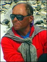 Wally Berg |
|
|
Hear Wally Berg describe his '97 summit climb |
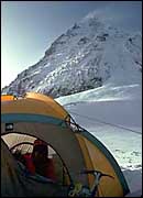
Symbolic Night on the Col
Hi, this is Wally Berg calling you guys from Everest Base Camp. Charles Corfield and I came down from Camp II, through the Ice Fall, and arrived at Base Camp about 10am. We're tired of course but doing good; its great to be down here.
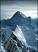
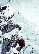
 South Col in '94 [click to zoom] (photo: Burleson/ Alpine Ascents) |
 Greg Wilson |
The Second Summit Bid
I am going to go back a bit to summit day because I feel like I need to fill in a little. I think you have an excellent account of our summit day from Todd Burleson. I might add just a personal perspective to some of that about especially the time on the summit.
What I am going to start with is just a chronology. At 11:30pm the night of the 24th (of course it was the 25th we summited,) I began climbing behind the others knowing that I had some guys that we were calling GPS Sherpas carrying my equipment. I had two things going on that day: one was we were very expressly climbing as a team. Todd Burleson and I talked about that at length as I was concerned that we had lost strength and stamina our second night at the Col in our aborted summit attempt the day before. We were not as strong, and we were worried about the weather as always. So, we wanted to stick together, but at the same time I had some Sherpas who were known to be particularly strong that had the equipment that I needed to get some of this GPS work done on the summit.
 Makalu (27,765') seen from upper Everest (photo: Alpine Ascents) |
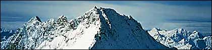
Lhotse Shar, Middle and Main (L to R) viewed across the South Col from the Triangular Face on Everest. [click to zoom]
(photo: Burleson/ Alpine Ascents)
Alone on the South Summit
From the Balcony, it became a bit more of a mountaineering type feeling in that we had what I call weird snow conditions. Cracks and heavily drifted snow, slabby like conditions — someone who works in avalanche-control like myself is very aware of the kind of snow that can move on you. We kinda treaded our way through this carefully, knowing that most of it, the worst of it, was not over any greatly exposed parts where the snow would move far or there was much below you. But as we began moving through this difficult snow, we were soon ascending towards the South Summit (28,700') of Everest. As I think has come through already I was able to make a radio call to Base Camp, Freddy and others that may have been patched through to Mountain Zone actually from the South Summit around 5am in the morning — 4:45am, Freddy tells me, he had a watch right on it.
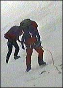
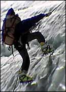 Climbing fixed ropes. [click to zoom] (photo: Burleson/ Alpine Ascents) |
The Weather Deteriorates
Tapke Sherpa showed up about 20 minutes behind me, and there was sort of this other thing that was going on though and that was the awareness that our beautiful summit day had actually deteriorated into a very questionable summit day by this time. I was thrilled to have that time alone on the South Summit; I was thrilled at how well we were all doing, but the weather was deteriorating. I think there may be some recorded radio conversations, at least from my end of the radio, Todd's may not have been quite as strong. [Burleson was having trouble with his radio and could not talk to Base Camp though he was in communication with Berg.]
It was not looking particularly good. When Tapke Sherpa showed up and waited for Ang Passang Sherpa and Mingma Sherpa, and I knew the others were close at that time; felt good about their progress and elected to go ahead to the summit and do what GPS work we could do.
 Climbers on the traverse from the South Summit to the Hillary Step in '92 [click to zoom] (photo: Burleson/ Alpine Ascents) |
It was windy. The summit traverse from South Summit over to Hillary Step and on to the true summit of Everest is quite spectacular and exposed — quite a mountaineering objective really in its own right. It was not particularly spectacular the morning we were there though because we were virtually in a whiteout by the time we were moving across. It was just the awareness that you were on a very thin knife-edge really with Tibet dropping off thousands of feet below you on one side and the Southwest Face of Everest on the other. These four Sherpas were competent climbers. We moved over the Hillary Step together quite well and arrived on the summit at 6:15am.
|
|
Hear Wally Berg on the summit of Everest [click for the transcript] |
Somewhere in here, in radio conversations with Todd, I became aware that the others had elected to turn back. We considered it a couple of times, and I think they made the proper decision, in that the traverse was really quite challenging in those conditions — high winds and low visibility.
From the South Summit on I had been trying to prioritize in my mind or decide how I was going to get some of this GPS work done, that my mentors and my idols, Bradford Washburn and Roger Bilham, had put so much thought and effort and work into — setting me up to get done for them. Of course, we had a totally different image: that we'd be up there walking around in a beautiful summit day, doing this and that, and making sure we got a lot of photos. I knew that that was all out the window, but I thought, 'well, we'll get something done for being up here.' You know, even the simplest things.
 The traverse from the South Summit to the Hillary Step in '94 [click to zoom] (photo: Burleson/ Alpine Ascents) |
The first thing I thought about was Bradford Washburn and his unending quest to know all there is you can know about Everest. Still thinks he hasn't mapped it well enough, and he wanted me to run a tape measure from the South Summit over to the Hillary Step, up the Hillary Step, and across to the summit. You know, this might seem laughable to some people, but I thought it was a great idea, and I had the tape measure in my pack. I had Tapke Sherpa with me, and I was going to have him run it out a hundred feet, and I would walk behind him and mark where he'd been, and we were going to get the measured foot-distance from the South Summit over to the summit. But I realized the wind was blowing way too hard (sorry about that, Brad — it didn't happen). The tape measure stayed in my pack.
I thought, 'well, we'll get up to the summit and see if we can drill this station for Brad's GPS receiver being mounted as the ongoing reference point,' probably at what we've referred to as Barry Bishop's Rock because of a famous photo he took in 1963 of Lute Jerstad crossing above this rock going to summit on the first American expedition. As we began to ascend, I became more skeptical there was going to be time to safely drill. I decided that one thing we could do would be to run a GPS receiver from the very top of the summit of Everest. I decided in my mind, 'I'm only going to run this thing for twenty minutes and it looks feasible.' And I thought Freddy — Fred Blume — and Roger Bilham and others would be very happy to get this much data anyway, and then we'll get safely out of here and call it a day.
 Summit hand-shake of '92 (photo: Alpine Ascents) |
I made one judgment error in that I allowed them to pack their loads by their own standards, which involves weight — which guy is feeling strong that day — as opposed to making sure that the pieces of equipment that I needed to arrive together would definitely arrive together, even if they didn't all get there.
Sticking to the GPS Plan
So we got to the summit in these extremely windy conditions. I made the decision to run the receiver for twenty minutes or so even though it may have been questionable at that. After it kinda sunk in that we were at the summit and kinda took in how hard the wind was blowing, I will always remember that when I said, 'GPS' to the Sherpas — in those exact words, I said 'GPS' — their eyes got real big. They looked at me like, 'you're crazy, you want us to take this out of our packs?' And I indicated, 'yes, I do. I want this stuff out,' and I started motioning for them to lift it out of their packs, which they did, and the result was pretty chaotic.
Things began to blow away. First a case with a cable, that was critical, blew away, but I wasn't worried because I had insisted on taking two receivers, two cables, and two GPS computers to the summit — at first thinking we'd run them simultaneously to get more data and kill less time, but also I was thinking, well, something like that might happen.
The Antenna
So, this thing blew away, and I thought, well, that's ok. Got this GPS antenna... I was mainly impressed with what these guys had told me it cost, you know. I knew it was a very expensive piece of equipment, and I set it down on some snow, getting ready to get the computer to hook up to it, which it turns out was in Nima Tashi's pack, well behind me all the time anyway, but we had not yet figured that out. But before I could worry about not having a computer to hook it up to, I watched it blow away with the little piece of snow I had set it on — which was very near the very tip-top summit of Everest — and down onto the rocks toward the Southwest Face. My first thought was, 'it's gonna blow down those rocks,' and then it kept going for a ways, and I thought, 'well, there it goes down the southwest face.'
It did, in fact, stop a ways down the face, and Fred Blume and I are sitting here looking at it right now — it's a little banged up... we need to hook it up and see if it still works. Unfortunately, it blew far enough down the face, that the twenty minutes I'd planned to run it was basically spent going down to get it, which I'm proud to say I did — I retrieved it. We'll see how rugged these things are when we hook it up here soon.
 The Southwest Face of Everest with the South Summit and Hillary Step in profile on the right ridge. [click to zoom] (photo: Burleson/ Alpine Ascents) |
My motivation was still very much to go get that damn antenna, hook it up, and run the thing for Roger Bilham and Fred Blume for ten minutes, or whatever I could do to say that some work had gone on at the summit that day. I realized, actually, after my two minutes — it might have been 12 or 15, I don't know — that I went down to get this thing and got back, the Sherpas had done a bit more of an inventory. They had managed to pull some things out of their packs and not lose them, and I realized that we were not going to be able, with the summit team that had come up together, to power up the GPS antenna and record any data.
At this time, "Wally Berg the Mountaineer" was probably thinking more than "Wally Berg the New GPS Researcher." I was thinking, 'It's time to go.' I remember having one radio call with Todd or Base Camp or somebody and saying just those words, 'we have to get out of here.'
Summit Prisms
The summit prisms that the Italians and especially the ones that Brad Washburn had put on the summit of Everest in '92, are still up there. They're bundled very differently than they used to be. The Italian tripod no longer really exists as a tripod. There's a sort of little summit shrine area now — stuff is bundled up in it.
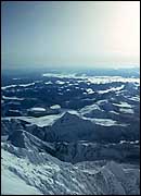 The Rongbuk Glacier flowing into Tibet, 1994 [click to zoom] (photo: Burleson/ Alpine Ascents) |
As I said, it was time to go. Myself and the four Sherpas began descending, knowing that our other teammates had turned around, and feeling that they had made the prudent decision. And of course, having in the back of our minds, besides the fact that we had a long descent to pull off and we needed to get home safely, the sense of accomplishment of having climbed Everest. Blown-away GPS equipment aside, we had gotten up Everest.
Still Climbing
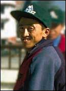 Tenzing Norbu Sherpa (photo: Alpine Ascents) |
These three guys were going to the summit of Everest, and they knew, and Lhakpa and I discussed when we met, that the others had all turned around. There was a sort of brief and knowing exchange of glances between two guys, myself and Lhakpa, who I consider a mountain guide's peer. I was thinking about what could happen, and the clear message was that they wanted to go to the summit for their own sake. They were close, and I gave the nod of approval for that and continued descending with the four guys that had summited with me.
 (photo: Alpine Ascents) |
— Wally Berg, Alpine Ascents 1997 Climbing Guide