
May 17-18, 2000

| »Home »Updates »Photos »Route Map »Sponsors |
|||||
Dear MountainZone.com,
Greetings from Barney Top in the Escalante Mountains. Mike and I decided that it was time you heard from me, so I will be keeping you current for the rest of our trip. I wanted to write to you last night but my hands were too cold to grip the pencil. At 7pm, it already was 30 degrees Fahrenheit and falling fast. Doesn't sound like the desert adventures that Mike described, does it? That's because we have climbed to 10,500 feet. Ahhhhh, but the adventure continues.
| "It's hard to believe that just a few days ago we were down there with the snakes and the scorpions. And now, here we are with the beavers and the elk and the wild turkeys!" |
Right now it 4:30am. The reason I'm awake and writing is so that I can periodically knock the snow off the tent. It's been snowing for hours. At least the drifts accumulating around the tent are insulating us from the cold. I'm no longer worried about freezing. I have new worries now: I can't help fantasizing about those days in the Grand Canyon when Mike and I had to hid under rocks with the lizards from the relentless sun.
But there's nothing quite as beautiful as a blanket of fresh snow, and this place was already drop-dead gorgeous without it. I can't wait until it's light enough to see what we've gotten ourselves into.
We are perched on the northwestern edge of this high plateau, and we have an incredible view. We can see Griffin Top, Boulder Mountain, the Henry Mountains, the Kaiparowits Plateau, and Canaan Peak. Below us is the town of Escalante, and the river system of the same name. Beyond that are the Circle Cliffs, the Waterpocket Fold and Capitol Reef National Park — an immense red rock wilderness spread out below us and ringed with forested mountains and plateaus. What an unbelievable place this is.
May 18, 2000
We survived another close call today. Yesterday morning we packed up in driving snow and slipped down the north side of Barney Top. The ground and sky were almost dry by the time we reached 9,200 feet, so we made the decision to not flee down into Escalante. Good call, as we would have missed much.
|
|
Let me catch you up from where Mike left off. It was really hard to resist the hospitality of Paria Outfitters and Guest Ranch, but we finally managed to hall ourselves away. We continued north up the Paria and into the cockscomb for our resupply. We had no trouble finding Glenn and his cooler on the dirt road, and we made merry until the wee hours. Steve and Susan of the Outfitters and Tania of the Guest Ranch even came out and helped us celebrate the starry night.
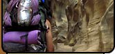
Glenn joined us the following morning and hiked with us for a day and a half as we entered Hackberry Canyon. We followed this gorgeous drainage for two days, then exited via Round Valley Draw. At its mouth, it looks like your typical desert canyon, but halfway through, it becomes a narrow slot. You can run your hands along both of its walls as you creep along. At points you can't even see the sky above.
After climbing and wrestling our packs up to the rim, we found ourselves in a totally different world.
Now in pinon and juniper forests broken by rocky outcroppings, sandstone bluffs, and huge sagebrush flats, we worked our way up onto the Slickrock Bench above Kodachrome Basin and camped on the edge. The scene sprawled out before us was unmistakably Utah. Beyond Kodachrome's white and red striped formations stood Bryce Canyon and all its funky pink cliffs towering above the ponderosas. What a place!
After that, we worked our way to the Dixie National Forest and followed an old pack trail around Canaan Peak. Then down into South Hollow, across Highway 12 and to the base of Barney Top. That day we climbed to the top via Water Canyon; we started out in shorts and T-shirts. By the time the sun set, we had on all our clothing and were huddled around the first and only fire we have had the entire trip. And that's the night it started to snow.
Until next time,
Joe Mitchell for Mitch and Mike (Coronella)
— Joe Mitchell, MountainZone.com Correspondent
| EXPEDITION DISPATCHES | |
|
|